File:Americanindiansmapcensusbureau.gif
Jump to navigation
Jump to search

Size of this preview: 800 × 594 pixels. Other resolutions: 2,560 × 1,902 pixels | 3,456 × 2,568 pixels.
Original file (3,456 × 2,568 pixels, file size: 647 KB, MIME type: image/gif, 0.2 s)
| Description |
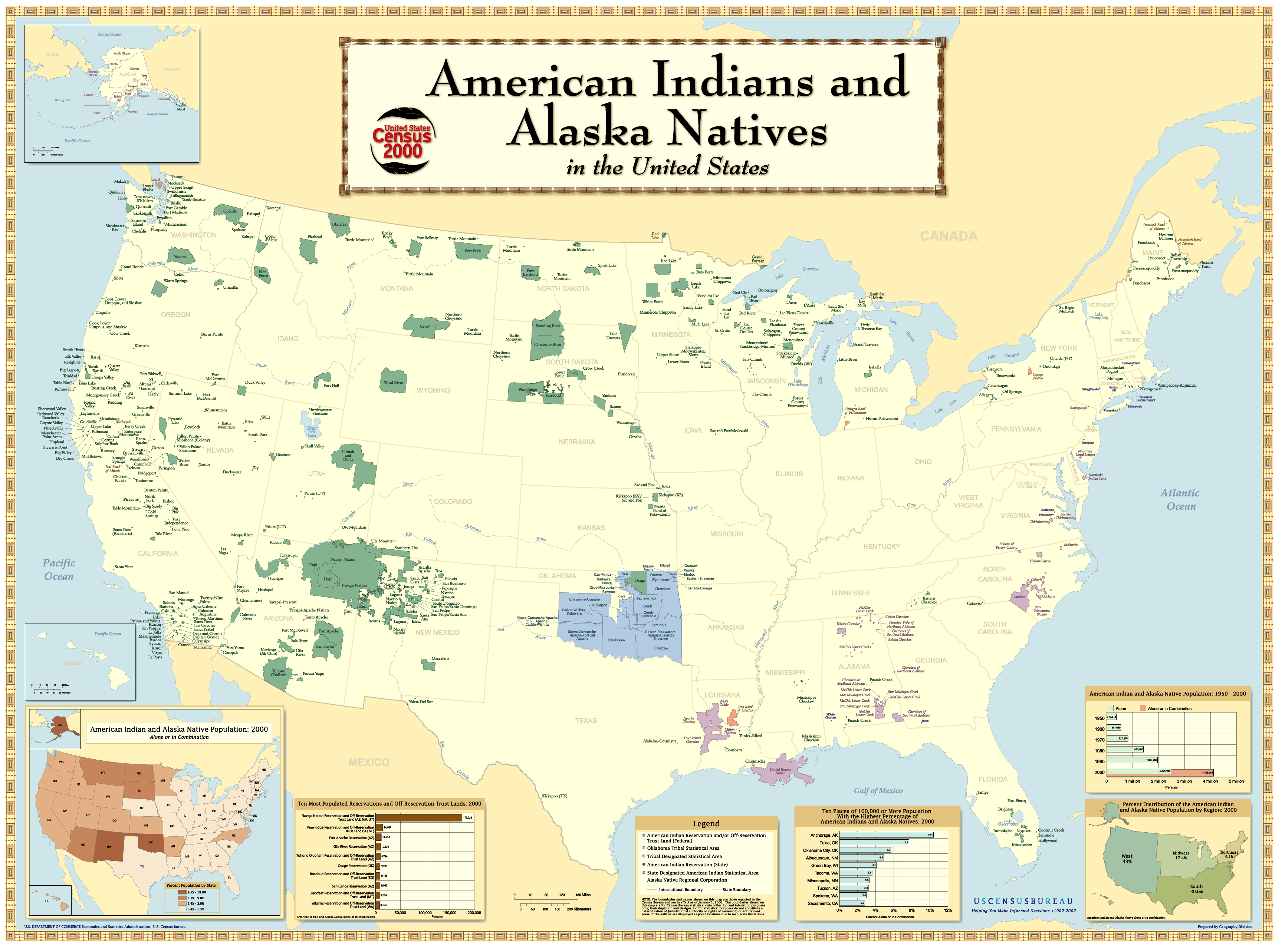
English: American Indian Reservations in the United States. | |||
|---|---|---|---|---|
| Author |
United States Census Bureau, Geography Division. | |||
| Source |
File:Americanindiansmapcensusbureau.gif in Wikimedia Commons (accessed 24 October 2013), citing http://www.census.gov/geo/www/maps/aian_wall_map/aian_wall_map.htm | |||
| Date |
Originally uploaded 1 August 2006. | |||
| Permission |
|

File history
Click on a date/time to view the file as it appeared at that time.
| Date/Time | Thumbnail | Dimensions | User | Comment | |
|---|---|---|---|---|---|
| current | ★ Approved revision 10:16, 24 October 2013 | | 3,456 × 2,568 (647 KB) | DiltsGD (talk | contribs) | {{Information | Description = '''English:''' American Indian Reservations in the United States. | Source = [http://commons.wikimedia.org/wiki/File:Americanindiansmapcensusbureau.gif File:Americanindiansmapcensusbureau.gif] in ''Wikimedia Commons'' (acces |
You cannot overwrite this file.
File usage
The following page uses this file: